The Outdoor Survival/Dungeons & Dragons Connection
a quick-n-dirty page by Jeff Rients
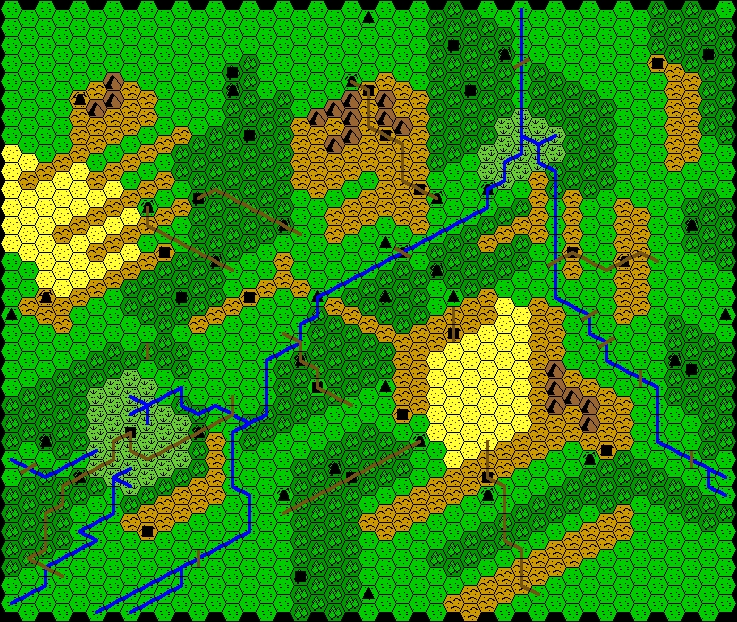
The Underworld & Wilderness Adventures, the third volume of the original Dungeons & Dragons little beige booklets booklets, contained a note about what it called "Off-hand adventures in the wilderness". As far as I can tell, the idea was that you could run random wilderness adventures along similar lines to the ever-popular random generic dungeon adventure. To this end the book recommends using the map from Outdoor Survival, an oddball Avalon Hill game first published in 1972. I have recreated this map using Bruce Gulke's easy-to-use Wilderness Mapper software. (Mr. Gulke is also the creator of the fantastic TableSmith utility.)
Hopefully the hills, mountains, forest, swamp, river, and roads are easy enough to identify. A black square represents a castle. Black triangles are towns. The black, vaguely cave-shaped symbol represents a monster lair. Per the original D&D rules the scale for this map is 5 miles per hex. The original rules also provided a cute chart for castle owners, with nifty results like an evil high priest with d20 white apes or a wizard guarded by d4 basilisks. I love random charts like that.